Research

Designing for Resiliency: Warren

Tactical retreat and redevelopment in one of Rhode Island’s coastal cities


As discussed in a previous post – Designing for Resiliency: Newport – Rhode Island’s Narragansett Bay coastline is home to most of the residents of the Ocean State. It is facing widespread coastal climate change, including rising sea levels, and flooding. Union has been working through locally tailored strategies to best address these threats.

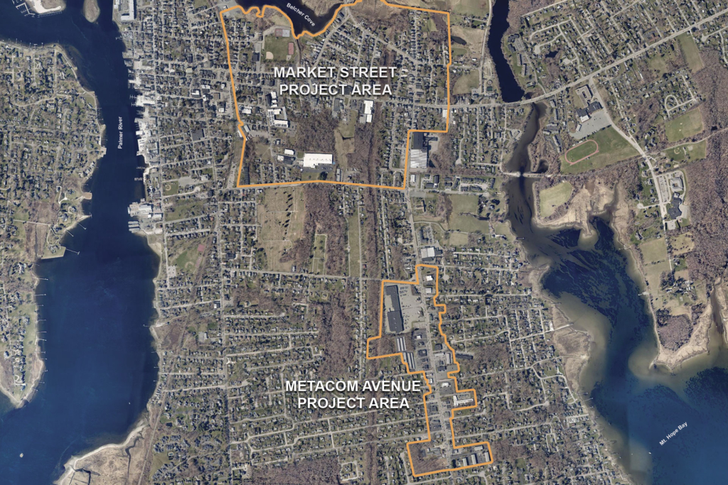
In 2021, Union was a partner consultant with Fuss & O’Neill working with leaders from the Town of Warren to create a community plan that addressed climate change challenges while promoting economic redevelopment. This was a logical next step to the 2019 forecasting and planning for municipal impacts due to climate change the town had completed on its own. The community plan focused on the Market Street neighborhood, which is projected to be underwater permanently.

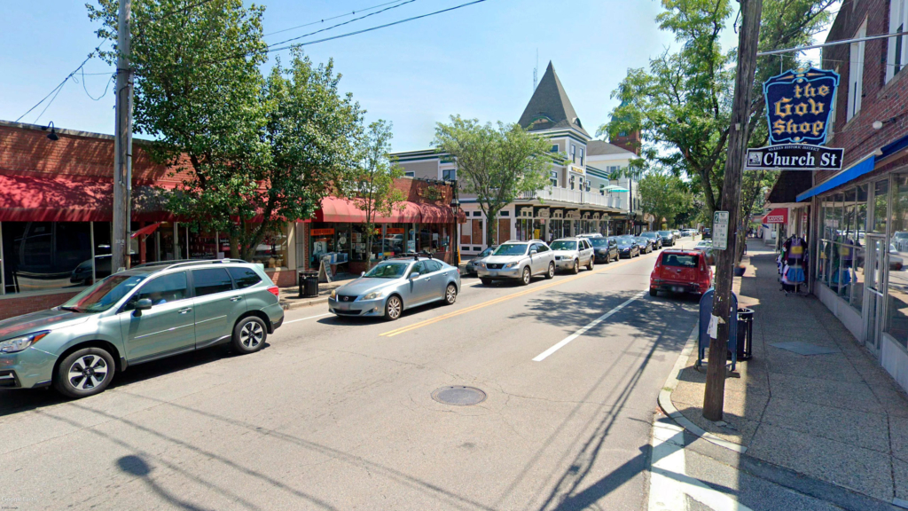
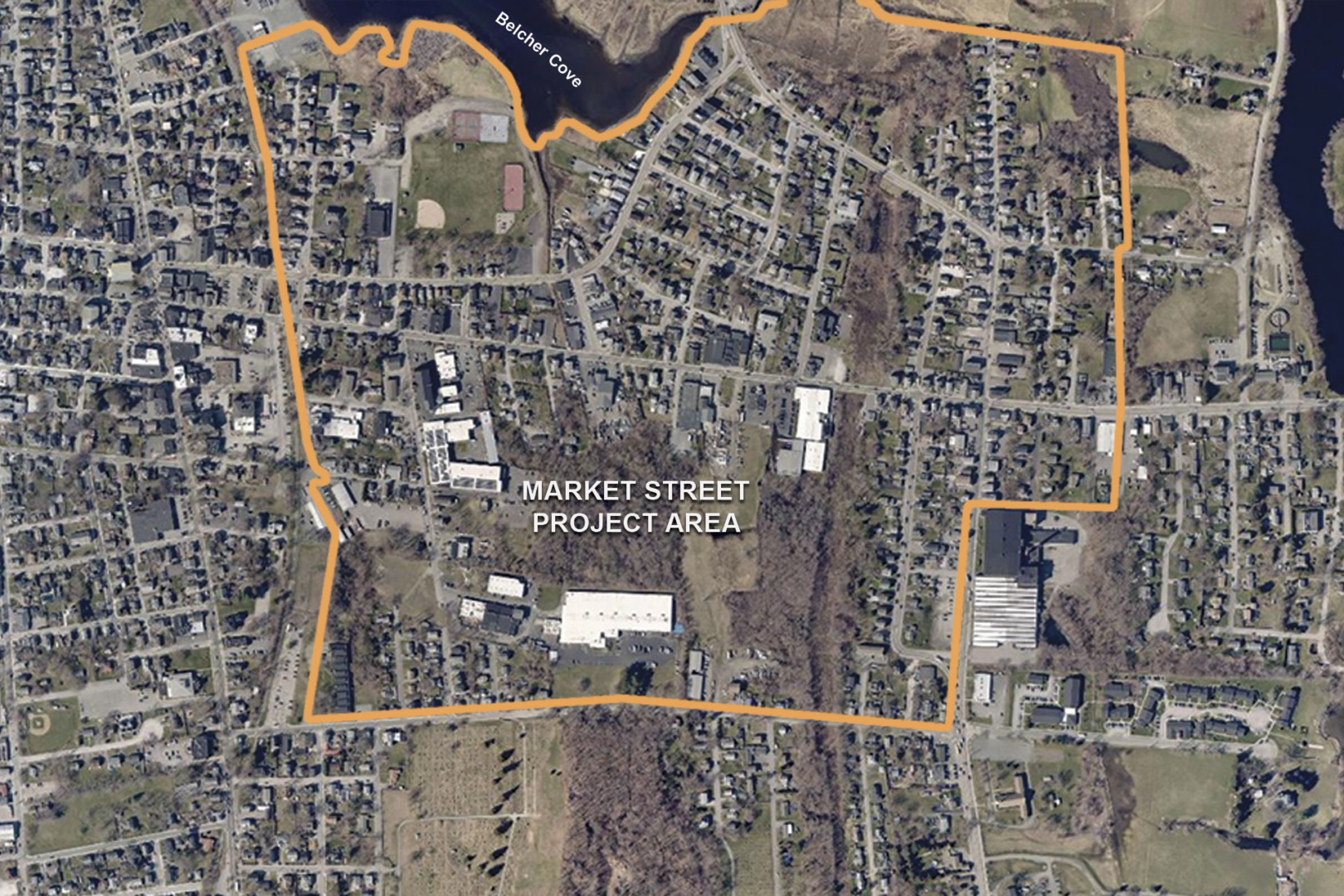
Warren, Rhode Island is situated between three significant waterways: the Palmer River, Belcher Cove, and Mt. Hope Bay. The Town of Warren, one of the few remaining working waterfronts in Rhode Island, is the smallest town in the smallest county in the smallest state in the nation. Its downtown has recently undergone a renaissance of sorts, attracting visitors and new families; however, the Market Street neighborhood is facing severe impacts from climate change with repeated inundation. These impacts will severely damage and destroy homes and businesses, state and town facilities, transportation routes, and environmentally sensitive sites. Nearly a tenth of the town’s 10,000-strong population lives in the Market Street area. Warren can’t afford to lose this valuable population. With fewer homes and businesses, the town would lose vital tax revenue – the lifeblood of any community.

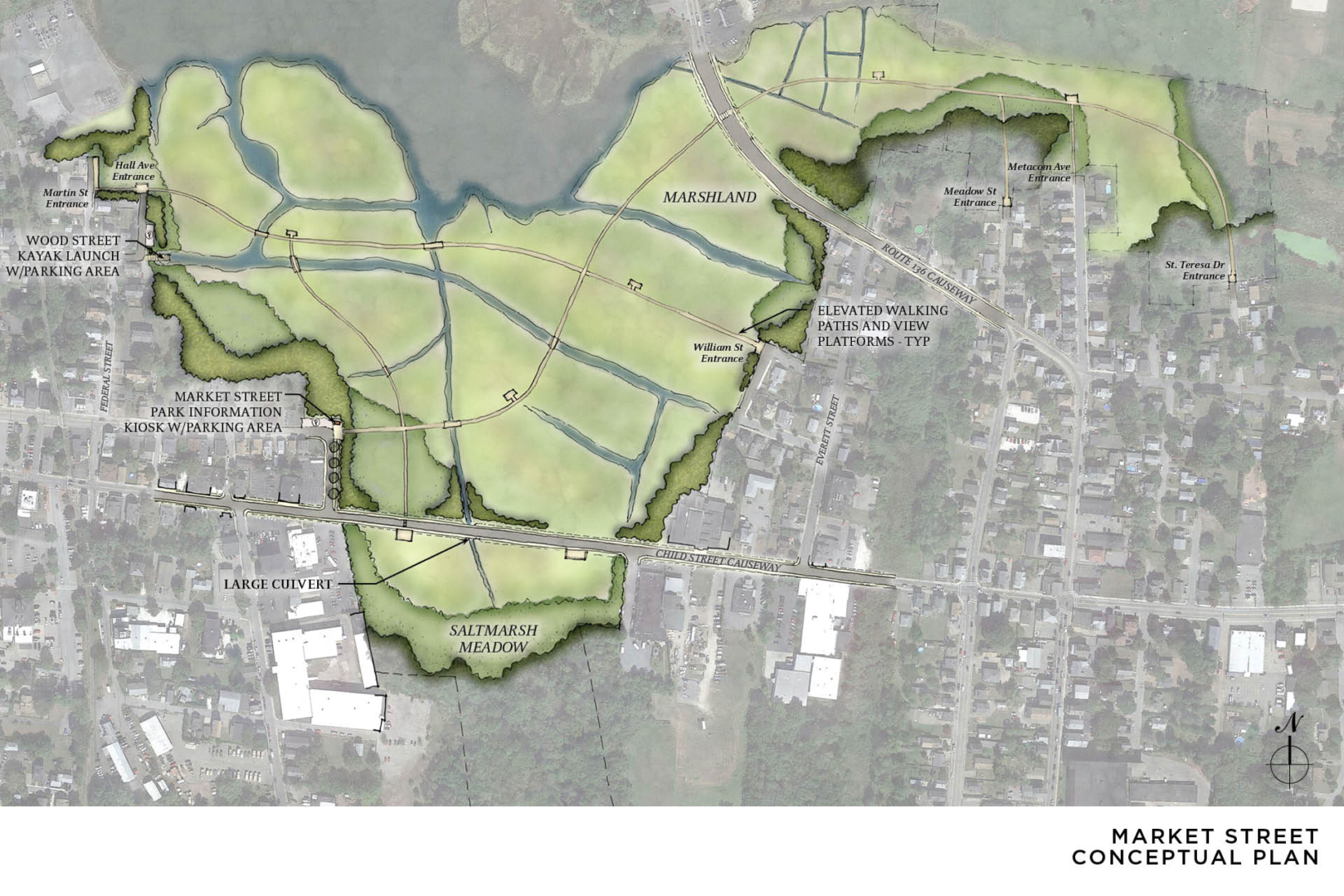
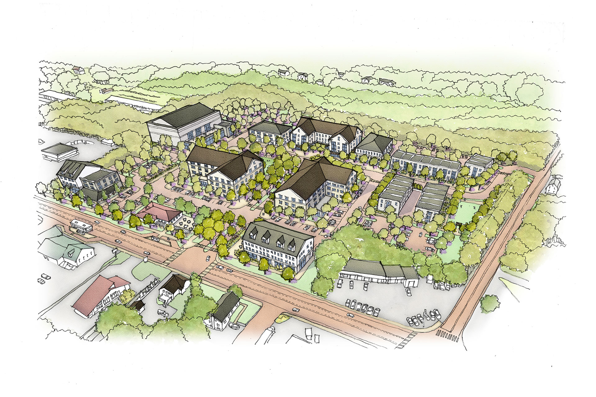
Warren’s Director of Planning and Community Development, Bob Rulli, with the project team, proposed giving up on nearly all the 184 acres around Belcher Cove – tearing the buildings down to the ground to revert to natural wetlands. This retreat would include offering buyouts to most of the area’s 400 residences and businesses over the next few decades.

Aerial map of Market Street project boundary
Conceptual marsh park for Market street area

Though this type of “managed retreat” is becoming increasingly common in flood-prone places around the country, Warren is the first community in the Ocean State to devise such a plan explicitly in response to climate change. By giving part of its land back to nature, the town is doing something that, within the national context, is far less common. But what to do with the lost businesses and housing that would no doubt have a huge impact on the town’s viability?

The other half of the plan is to create a brand-new neighborhood less than a mile away on the higher ground of the Metacom Avenue corridor. This new neighborhood would have attractive housing and spacious storefronts, where the displaced residents and businesses can go to get out of the flood zone. Currently, the Metacom Avenue corridor is an auto-centric district. Because it’s on higher ground, its vulnerability to climate change impacts, especially flooding, is substantially lower. Additionally, the demand for real estate in land-use environments like this continues to decline. The team recognized the potential opportunity for redevelopment of the Metacom Avenue corridor as a mixed-use, human-scaled street that contains retail, employment facilities, and housing in a “Main Street” type setting.

Aerial map of Metacom Avenue project boundary
Conceptual plan with potential land uses for Metacom Avenue

To affect these changes in the Metacom Avenue project area, it was determined that the Town of Warren, in partnership with State, Federal, and regional partners should take the following actions:

  • Update Warren’s Comprehensive Plan. Include language to support goals for a redeveloped Metacom Avenue corridor, mixed-use redevelopment, development of workforce housing, complete streets redesign for Metacom Avenue, upgraded utilities to support higher density, and increased RIPTA bus service.
  • Amend local zoning ordinance for Metacom Ave. Implement form-based code for Metacom Avenue, permit mixed-use development by-right, permit high-density residential land uses by-right, and enact a stormwater overlay district.
  • Advocate for supportive state actions. Advocate for RIDOT to complete street design for Metacom Ave; RIDOT to adapt vulnerable sections of Route 136 to withstand sea level rise and storm events and potentially become part of flood control system; RIPTA to increase transit service to the Metacom Ave corridor to support high-density residential uses.
  • Enact Tax Incremental Financing (TIF). Enact Tax Incremental Financing (TIF) to support buy-out programs and infrastructure upgrades.
  • Secure funding. Secure funding from state and federal sources needed for infrastructure improvements.
  • Set up a redevelopment agency. Set up a redevelopment agency needed to enact comprehensive community plan goals.
  • Upgrade utilities. To support higher density redevelopment, make them more resilient to climate change impacts, and reconfigure stormwater management systems.

The Town of Warren has a limited-time opportunity to plan for a linked future for both Market and Metacom. By adapting to climate change impacts and minimizing flood vulnerability and environmental risk, Metacom corridor can be an improved, livable center for Warren’s citizens.

Conceptual bird's eye drawing of potential transformation on Ocean State Job Lot property